%20-%20https://sketchapp.com%20--%3e%3ctitle%3e178342C7-E563-41CE-8EC0-A9A54298CB55%3c/title%3e%3cdesc%3eCreated%20with%20sketchtool.%3c/desc%3e%3cdefs%3e%3ccircle%20id='path-1'%20cx='25'%20cy='25'%20r='25'%3e%3c/circle%3e%3c/defs%3e%3cg%20id='Page-1'%20stroke='none'%20stroke-width='1'%20fill='none'%20fill-rule='evenodd'%3e%3cg%20id='Transparenz'%20transform='translate(-1158.000000,%20-29.000000)'%3e%3cg%20id='Header'%20transform='translate(108.000000,%2031.000000)'%3e%3cg%20id='Profile'%20transform='translate(1052.000000,%200.000000)'%3e%3cg%20id='CI-Placeholder'%3e%3cmask%20id='mask-2'%20fill='white'%3e%3cuse%20xlink:href='%23path-1'%3e%3c/use%3e%3c/mask%3e%3cuse%20id='Background'%20stroke='%239b9b9b'%20stroke-width='2.5'%20xlink:href='%23path-1'%3e%3c/use%3e%3cpath%20d='M24.9650909,39.2018953%20C22.42,39.2018953%2020.2218182,37.8707667%2019.6992727,36.1567717%20L20.7421818,36.1567717%20C21.1643636,36.1567717%2021.5058182,35.8072948%2021.5058182,35.3765701%20L21.5058182,32.1288835%20C22.5618182,32.6530989%2023.7465455,32.9491525%2025,32.9491525%20C26.2534545,32.9491525%2027.4381818,32.6530989%2028.4941818,32.1299965%20L28.4941818,35.3765701%20C28.4941818,35.8072948%2028.8367273,36.1567717%2029.2589091,36.1567717%20L30.232,36.1567717%20C29.7083636,37.8707667%2027.5101818,39.2018953%2024.9650909,39.2018953%20M18.58,25.4008967%20L18.0956364,20.5093332%20C18.0661818,20.2411041%2018.0465455,19.969536%2018.0465455,19.6924031%20C18.0465455,15.7591185%2021.1665455,12.5592902%2025,12.5592902%20C28.8345455,12.5592902%2031.9534545,15.7591185%2031.9534545,19.6924031%20C31.9534545,19.969536%2031.9349091,20.2411041%2031.9010909,20.5605304%20L31.4189091,25.4053487%20C31.1047273,28.8177569%2028.3458182,31.3898623%2025,31.3898623%20C21.6552727,31.3898623%2018.8963636,28.8177569%2018.58,25.4008967%20M32.6341818,34.5974815%20L30.0225455,34.5974815%20L30.0225455,31.1327631%20C31.6327273,29.7982955%2032.7290909,27.8305403%2032.9396364,25.5567145%20L33.4218182,20.6851846%20C33.4578182,20.3579674%2033.4818182,20.0274112%2033.4818182,19.6924031%20C33.4818182,14.8998951%2029.6767273,11%2025,11%20C20.3232727,11%2016.5192727,14.8998951%2016.5192727,19.6924031%20C16.5192727,20.0274112%2016.5421818,20.3579674%2016.5792727,20.7174611%20L17.0603636,25.5511496%20C17.2709091,27.8283143%2018.3672727,29.7971826%2019.9785455,31.1327631%20L19.9785455,34.5974815%20L17.3658182,34.5974815%20C11.6505455,34.5974815%207,39.3643909%207,45.2209114%20C7,45.6516361%207.34254545,46%207.76363636,46%20C8.18581818,46%208.52836364,45.6516361%208.52836364,45.2209114%20C8.52836364,40.2225014%2012.4916364,36.1567717%2017.3658182,36.1567717%20L18.1316364,36.1567717%20C18.6192727,38.7555888%2021.4938182,40.7600725%2024.9661818,40.7600725%20C28.4374545,40.7600725%2031.312,38.7555888%2031.7996364,36.1567717%20L32.6341818,36.1567717%20C37.5083636,36.1567717%2041.4727273,40.2225014%2041.4727273,45.2209114%20C41.4727273,45.6516361%2041.8141818,46%2042.2363636,46%20C42.6585455,46%2043,45.6516361%2043,45.2209114%20C43,39.3643909%2038.3505455,34.5974815%2032.6341818,34.5974815'%20id='Icon'%20fill='%239b9b9b'%20mask='url(%23mask-2)'%3e%3c/path%3e%3c/g%3e%3c/g%3e%3c/g%3e%3c/g%3e%3c/g%3e%3c/svg%3e)


Desde18,40€
Camping Les Platanes
- Horas de funcionamiento: 01.04 - 15.10 - actualmente en funcionamiento
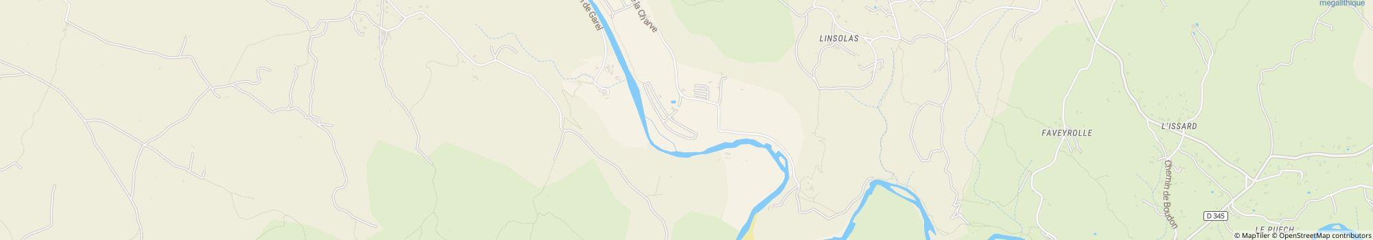
- Dirección: La Charve, 07260 Rosieres, Francia - Mostrar en el mapa
- Región: ArdècheArgentièiraPrivàsSur de Francia
Calificaciones
Valoraciones en detalle
- Tranquilidad4.0
- Comida / Tiendas4.0
- Limpieza general4.0
- Limpieza de las instalaciones sanitarias4.0
- Amabilidad5.0
- Infraestructura5.0
- Actividad(es) de entretenimiento4.0
- Lugar4.0
- Relación calidad-precio5.0
- Instalaciones sanitarias4.0
Lo que escriben los invitados
Actividades recomendadas por los invitados
Calificado por invitados como "Adecuado para"
Huéspedes con tiendas de campaña
Huéspedes con perros
Familias con niños menores de 12 años
Familias con niños menores de 6 años
Parejas
Personas mayores
Grupos de jóvenes
Familias con niños menores de 18 años
Descripción
Perfil
Welcome to Les Platanes Campsite Ardeche. Located on a riverbank in "La Beaume" canyon, our campsite is surrounded by exceptional natural beauty, vineyards and white limestone cliffs.
- Categoría de camping:
- Tamaño del sitio: 5 ha (Condiciones del suelo: Césped)
- Número total de parcelas: 151
- Parcelas para caravanas frente a la entrada: No disponible
- Parcelas de escala delante de las puertas también para caravanas: No disponible
Precio de referencia
Temporada alta 32,50 €*
Temporada baja 18,40 €*
*Dos adultos, caravana, coche, electricidad y tasas locales por noche
Horas de funcionamiento
01. abril - 15. octubre
Ubicación
Indicaciones
- Access to the campsite: From the North: From the A7 highway take Montelimar Nord exit, then direction "Le Teil" then Aubenas via the N102, then towards Alès and Rosières up to the D 104. From the highway A75: take …
- Río: En el sitio
- Altura sobre el nivel del mar): 130 m
- Siguiente ciudad: 20 km
- Siguiente ciudad/pueblo: 4 km
- Estación de tren o autobús: 4 km
Dirección
La Charve
07260 Rosieres FranciaCoordenadas GPS
Lat 44.45651, Long 4.27814
Obtener indicaciones de cómo llegar