%20-%20https://sketchapp.com%20--%3e%3ctitle%3e178342C7-E563-41CE-8EC0-A9A54298CB55%3c/title%3e%3cdesc%3eCreated%20with%20sketchtool.%3c/desc%3e%3cdefs%3e%3ccircle%20id='path-1'%20cx='25'%20cy='25'%20r='25'%3e%3c/circle%3e%3c/defs%3e%3cg%20id='Page-1'%20stroke='none'%20stroke-width='1'%20fill='none'%20fill-rule='evenodd'%3e%3cg%20id='Transparenz'%20transform='translate(-1158.000000,%20-29.000000)'%3e%3cg%20id='Header'%20transform='translate(108.000000,%2031.000000)'%3e%3cg%20id='Profile'%20transform='translate(1052.000000,%200.000000)'%3e%3cg%20id='CI-Placeholder'%3e%3cmask%20id='mask-2'%20fill='white'%3e%3cuse%20xlink:href='%23path-1'%3e%3c/use%3e%3c/mask%3e%3cuse%20id='Background'%20stroke='%239b9b9b'%20stroke-width='2.5'%20xlink:href='%23path-1'%3e%3c/use%3e%3cpath%20d='M24.9650909,39.2018953%20C22.42,39.2018953%2020.2218182,37.8707667%2019.6992727,36.1567717%20L20.7421818,36.1567717%20C21.1643636,36.1567717%2021.5058182,35.8072948%2021.5058182,35.3765701%20L21.5058182,32.1288835%20C22.5618182,32.6530989%2023.7465455,32.9491525%2025,32.9491525%20C26.2534545,32.9491525%2027.4381818,32.6530989%2028.4941818,32.1299965%20L28.4941818,35.3765701%20C28.4941818,35.8072948%2028.8367273,36.1567717%2029.2589091,36.1567717%20L30.232,36.1567717%20C29.7083636,37.8707667%2027.5101818,39.2018953%2024.9650909,39.2018953%20M18.58,25.4008967%20L18.0956364,20.5093332%20C18.0661818,20.2411041%2018.0465455,19.969536%2018.0465455,19.6924031%20C18.0465455,15.7591185%2021.1665455,12.5592902%2025,12.5592902%20C28.8345455,12.5592902%2031.9534545,15.7591185%2031.9534545,19.6924031%20C31.9534545,19.969536%2031.9349091,20.2411041%2031.9010909,20.5605304%20L31.4189091,25.4053487%20C31.1047273,28.8177569%2028.3458182,31.3898623%2025,31.3898623%20C21.6552727,31.3898623%2018.8963636,28.8177569%2018.58,25.4008967%20M32.6341818,34.5974815%20L30.0225455,34.5974815%20L30.0225455,31.1327631%20C31.6327273,29.7982955%2032.7290909,27.8305403%2032.9396364,25.5567145%20L33.4218182,20.6851846%20C33.4578182,20.3579674%2033.4818182,20.0274112%2033.4818182,19.6924031%20C33.4818182,14.8998951%2029.6767273,11%2025,11%20C20.3232727,11%2016.5192727,14.8998951%2016.5192727,19.6924031%20C16.5192727,20.0274112%2016.5421818,20.3579674%2016.5792727,20.7174611%20L17.0603636,25.5511496%20C17.2709091,27.8283143%2018.3672727,29.7971826%2019.9785455,31.1327631%20L19.9785455,34.5974815%20L17.3658182,34.5974815%20C11.6505455,34.5974815%207,39.3643909%207,45.2209114%20C7,45.6516361%207.34254545,46%207.76363636,46%20C8.18581818,46%208.52836364,45.6516361%208.52836364,45.2209114%20C8.52836364,40.2225014%2012.4916364,36.1567717%2017.3658182,36.1567717%20L18.1316364,36.1567717%20C18.6192727,38.7555888%2021.4938182,40.7600725%2024.9661818,40.7600725%20C28.4374545,40.7600725%2031.312,38.7555888%2031.7996364,36.1567717%20L32.6341818,36.1567717%20C37.5083636,36.1567717%2041.4727273,40.2225014%2041.4727273,45.2209114%20C41.4727273,45.6516361%2041.8141818,46%2042.2363636,46%20C42.6585455,46%2043,45.6516361%2043,45.2209114%20C43,39.3643909%2038.3505455,34.5974815%2032.6341818,34.5974815'%20id='Icon'%20fill='%239b9b9b'%20mask='url(%23mask-2)'%3e%3c/path%3e%3c/g%3e%3c/g%3e%3c/g%3e%3c/g%3e%3c/g%3e%3c/svg%3e)


Alkaen26,00€
Storängens Camping, Stugor & Outdoor
- Toiminta-ajat: 30.04 - 20.09 - tällä hetkellä suljettu
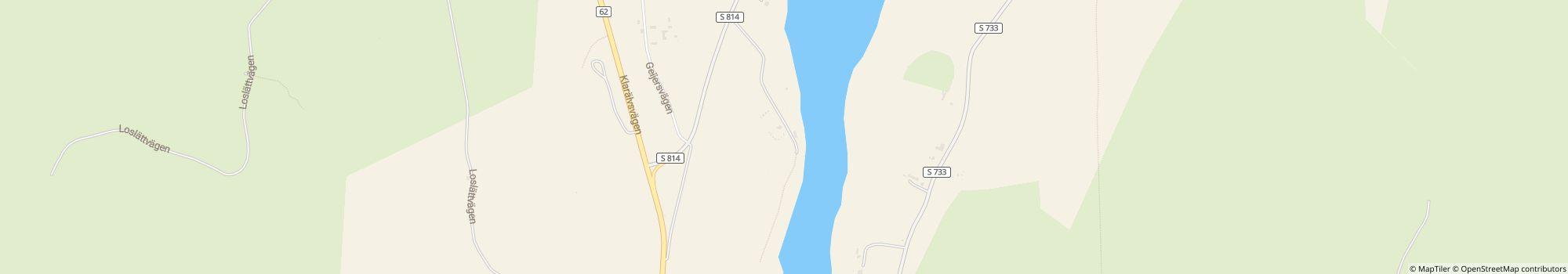
- Osoite: Erlandervägen 2, 68493 Ransäter, Ruotsi - Näytä kartalla
- Alueella: Värmlanti
Arviot
Arviot yksityiskohtaisesti
- Rauhallisuus4.8
- Ruoka/kaupat3.3
- Yleinen siisteystaso5.0
- Saniteettitilojen siisteys4.3
- Ystävällisyys5.0
- Infrastruktuuri3.5
- Vapaa-ajan aktiviteetit3.5
- Sijainti4.0
- Vastine rahalle4.7
- Saniteettitilat4.3
Mitä vieraat kirjoittavat

Helmut M.
Majoitusaika: kesä 2010
Vieraiden suosittelemia aktiviteetteja
Nähtävyyksiä
(1 Vieras)Uinti
(1 Vieras)Vieraiden arvioima "Sopii"
Pariskunnat
Koiranomistajat
Eläkeläiset
Nuorisoryhmät
Telttailijat
Perheet, lapset alle 18 v.
Perheet, lapset alle 12 v.
Perheet, lapset alle 6 v.
Kuvaus
Profiilini
The campsite is located in Sweden in the heart of the beautiful province Värmland, where the river “Klarälven” crosses the landscape. A province that is famous for its folklore and its beautiful nature, with huge forests, rivers and many lakes. …
- Leirintäalueen luokka:
- Sivuston koko: 15 ha (Maaolosuhteet: Grass)
- Pelipaikkojen kokonaismäärä: 49
- Turistipaikkojen määrä: 49 (Joista paketeista: 40)
- Matkailuautopaikkoja porttien edessä: 0
- Pysähdyspaikat porttien edessä myös matkailuvaunuille: Ei saatavilla
Viitehinta
Huippukausi 30,00 €*
Hiljainen kausi 26,00 €*
*Kaksi aikuista, asuntovaunu, auto, sähköt ja paikalliset verot per yö
Toiminta-ajat
30. huhtikuu - 20. syyskuu
Ominaisuudet
Tilat
- Hiiligrilli sallittu
- Internet-pääte(9 km)
- Kaasupullojen vaihto(9 km)
- Kuivausrummut
- Matkailuautojen huoltopiste
- Oleskelutilat
- Polttopuita saatavilla
- Pyykinpesukoneet
- Pöytiä ja penkkejä
- Wi-Fi
- Yhteinen nuotiopaikka
- Yksittäiset pesukaapit(9)
- Kuivaushuone
- Säilytyslokerot
Parkkipaikalla
- Auto sallittu leiriytymispaikalla
- Sähköliitäntä
- Varjoisia alueita(Little shade)
- Autottomat leiriytymispaikat
- Erillinen tila nuorisoryhmille
- Kaasupulloliitäntä paikalla
- Kemikaali-wc:n tyhjennyspiste
- Leiritulen tekeminen sallittu
- TV-liitäntä paikalla
- Vesiliittymä paikalla
Lemmikit
- Koirapuisto
- Koirat sallittuja hiljaisella kaudella
- Koirat sallittuja huippukaudella
- Koirat sallittuja vuokrattaviin majoitustiloihin
- Koirien uimaranta
- Suihkut koirille
Perhe & Lapset
- Lastenhoitohuono
- Leikkipuisto
- Eläintarha
Uinti & Hyvinvointi
- Avovesiuinti(River)
- Hiekkaranta
- Kuumia lähteitä(30 km)
- Sauna(9 km)
- Sisäuima-allas(9 km)
- Ulkouima-allas(30 km)
- Vesiliukumäki(30 km)
- Nudistiranta
Vapaa-ajan mahdollisuudet
- Golf(30 km)
- Kalastus
- Minigolf
- Polkupyörävuokraus
- Pöytätennis
- Ratsastus(8 km)
- Hiihtohissi
- Lentopallo
- Liukumäki
- Murtomaahiihto
- Purjehdus
- Purjelautailu
- Sukelluspaikka
- Tennis
- Venevuokraus
Hinta ja ateriapalvelut
- Keittomahdollisuudet
- Kioski(01.06.-31.08.)
- Leipää myynnissä alueella
- Ravintola(15.06.-20.08.)
- Ruokakauppa(01.06.-31.08.)
Esteettömyys
- Esteettömät saniteettitilat
- Esteetön pääsy veteen
- Useimmat polut kivetty
- Pyörätuoliluiskat
Vuokra-asunnot
- Loma-asunnot
- Mökit
- Vuokrateltat
- Asuntovaunujen vuokraus
- Mökkejä
Loman tyyppi
- Pysyvä leiriytyminen
- Nudismi
- Pieni leirintäalue
- Talvileiriytyminen
Sijainti
Ohjeet
Road Map If you come from Copenhagen (Denmark), you can go with the Øresund bridge to Malmö. Then you follow the E6 to Göteborg, you will follow this road till Uddevalla. Then you follow the 44 to Vänersborg and after …
- Järvi: 9 km
- River: Alueella
- Vuoristossa: Ei
- Seuraava kaupunki: 50 km
- Seuraava kaupunki/kylä: 9 km
- Rautatie- tai linja-autoasema: 1 km
- Moottoritien ramppi: 1 km
Osoite
Erlandervägen 2
68493 Ransäter RuotsiGPS-koordinaatit
Lat 59.763501945690074, Long 13.448721661376947
OhjeetYhteydenotto
Storängens Camping, Stugor & Outdoor
Soita tai faksaa